North Campus
Courses Offered at the North Campus
Curriculum Courses
Please note: Courses are announced each semester. If the Class Finder linked above does not show classes, the schedule has not yet been released for the next semester.
Economic & Workforce Development Classes
Browse Workforce Development Classes
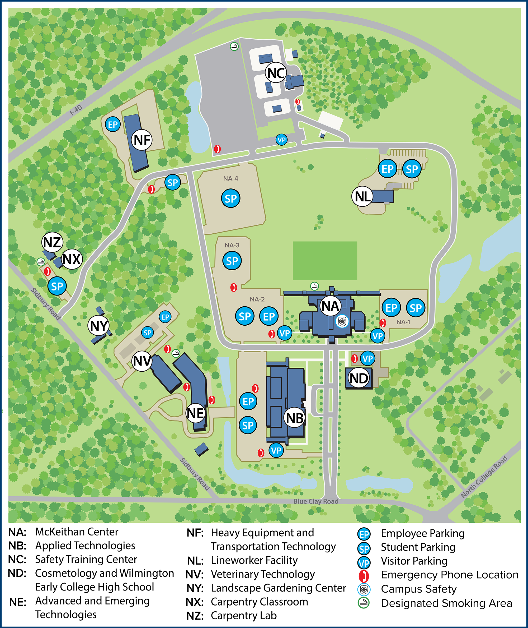
North Campus Map
Directions to the North Campus:
4500 Blue Clay Road, Castle Hayne North Carolina 28429
I-40 East (coming from Raleigh area, etc)
- Cross the Northeast Cape Fear River bridge
- Take the # 414 exit
- Turn left at the stop sign (this is Holly Shelter road toward Castle Hayne and the Brunswick County Beaches)
- Turn left at the stoplight (this is Highway 133/117 South)
- Stay in the left lane and bear left at the fork in the road (this is Hwy. 132/117)
- Continue 1.6 miles to the stoplight (Blue Clay Road intersection)
- Turn left at the stoplight – the campus will be on the immediate right.
I-40 West (coming from Wilmington area)
- Leave I-40 on exit # 420-B. Follow the exit across the overpass and merge onto Highway 132/117 (North College Road).
- Continue driving north until you pass Laney High School, NorthChase Subdivision and go over a large highway overpass.
- The next traffic light will be Blue Clay Road. Turn to the right onto Blue Clay Road, travel approximately 300 feet and turn to the right into the main driveway of the campus.
Hwy 74/76 (Coming from I-95)
- Exit I-95 at Lumberton. It will take approximately 1 hour to reach the Wilmington area from this exit.
- Hwy. 74 and 76 will merge and become one. Follow it through the Leland area and toward the Cape Fear River – Wilmington area.
- Before crossing the river use the right exit (to U.S.S. North Carolina Battleship Memorial), go under Hwy. 74/76 and merge onto Highway 421 North.
- Go north approximately 1 mile and make a right turn at the 1st traffic light (Parsley Street), cross the Isabella Holmes Bridge and continue on to the MLK Parkway.
- Follow the MLK Parkway and exit at the Burgaw Highway 133 ramp.
- Follow Highway 133 to the 2nd traffic light and turn right onto N. Kerr Avenue.
- Follow N. Kerr Avenue to the next traffic light and turn left onto Blue Clay Road.
- Follow Blue Clay Road approximately 3 miles to the traffic light at Highway 132/117 (N. College Road).
- Go under the light at Highway 132/117. You will immediately enter a slight curve in the highway. At the end of the curve move into the right lane and turn into the main entrance of the campus.
From The East (Jacksonville)
- Take Highway 17 Southwest to Scotts Hill at Poplar Grove Plantation.
- Turn right on Sidbury Road (Methodist Church at this intersection).
- Drive 6 miles, crossing I-40, until Sidbury Road dead ends at Blue Clay Road.
- Turn left on Blue Clay and drive approximately 250 feet and turn left onto the college campus.